Great Britain's trusted supplier of Average Speed and Speed Limit data
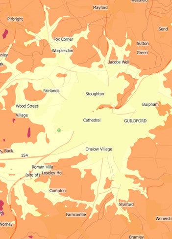
Enhance routing, uncover congestion with accurate average speed insights.
Identify speeding hotspots with precise speed limit data analysis.
Trusted by government, free for PSGA members, available commercially for the private sector.


TM Average Speeds: Unlock Accurate, Real-World Traffic Insights for Smarter Planning
TM Speeds is a powerful dataset developed in partnership with Trafficmaster, leveraging their market-leading raw GPS speed data. Designed for seamless integration with Basemap’s industry-leading TRACC and Highways Analyst software, TM Speeds provides unparalleled accuracy for transport planning, congestion analysis, and route optimisation.
Key Benefits:
✔ Enhance TRACC & Highways Analyst outputs – Improve the accuracy of accessibility and journey time analysis.
✔ Custom analysis for new developments – Assess congestion impacts and travel times around proposed sites.
✔ Optimise route and travel time analysis – Gain insights across 14 weekly time periods.
✔ Improve logistics planning – Estimate delivery times and optimise visit, delivery, and collection sequences.
✔ Support emergency response planning – Develop faster, more effective emergency routing strategies.
✔ Monitor trends over time – Compare year-on-year changes in drive times.
✔ Accurate, real-time insights – Ensure immediate and precise drive time analysis.
Trusted by government and available through the PSGA for public sector users, TM Speeds is also commercially available for private sector applications. Whether planning new developments, optimising logistics, or enhancing road network analysis, TM Speeds delivers the trusted data you need for smarter decision-making.


BM-SpeedLimits: Complete, Accurate Speed Limit Data for Great Britain
Basemap has been collating and refining speed limit data to enhance Ordnance Survey’s premium products, providing a crucial missing piece to the ITN, Highways Network, and now the MRN.
The BM-SpeedLimits Dataset delivers detailed, high-accuracy speed limit information, supporting essential transport, insurance, and infrastructure applications across the UK.
Built for Accuracy & Reliability
✔ 100% coverage across Great Britain – Comprehensive and continuously updated.
✔ Derived from authoritative sources – Originally compiled from local authority data, with ongoing updates from police forces, telematics data, and user feedback.
✔ Trusted for critical applications – Used by mapping providers, utilities, delivery companies, and insurers.
✔ Supports insurance telematics – Enables accurate monitoring of speeding events against black box data for risk assessment and pricing.
✔ Essential for compliance & analysis – Helps identify speeding hotspots, optimise routing, and improve transport planning.
BM-SpeedLimits ensures the most accurate, up-to-date speed limit data, trusted by government and available through the PSGA for public sector users, or commercially for private sector applications.