
DataCutter: Instant Access to the Data You Need
Unlock a wide range of high-quality datasets including public transport (GTFS), points of interest (POI), bus routes, road networks, postcodes, and census data. Simply draw your own boundary and download curated datasets for any location in Great Britain—or seamlessly access detailed public transport and road data for over 16,000 locations worldwide. Now powered by a faster, more scalable backend and updated continuously with the latest data.

Detailed Points of Interest (POI) Data
Identify and analyse locations by function, land use, address, or coordinates to support spatial analysis and planning. Access rich OS POI datasets for Great Britain or take advantage of continuously updated global POI from OpenStreetMap (OSM), automatically refreshed and harmonised via DataCutter’s scalable backend.

Comprehensive Public Transport Data
Access detailed National Public Transport Access Nodes (NaPTAN) for accurate stop locations across buses, trams, trains, and ferries. Combined with nationwide timetable data (TNDS) and route line geometry, this enables powerful multimodal transport planning and accessibility analysis. International GTFS feeds are also available for global transit insight.

Road Network & Census
Access high-quality road infrastructure datasets, including OS MasterMap® Highways Network, Multi-Modal Routing Network (MRN), and OS Open Roads for Great Britain, with global road coverage powered by regularly updated OpenStreetMap (OSM) data. Combine this with UK census data from 2011 and 2021 or US Census datasets to support detailed infrastructure planning, demographic analysis, and spatial modelling.
How Does DataCutter work?

Why Choose DataCutter?
Customised Data Selection
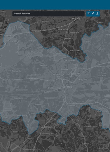
Draw your own map boundary or select from predefined administrative areas within the new DataCutter platform to access precise, location-specific datasets—across Great Britain or globally.
Instant, Ready-to-Use Data
Save time with immediate access to a wide range of harmonised, analysis-ready datasets—no need for manual processing or reformatting.
Seamless TRACC Integration
Export directly into TRACC with no conversion required. DataCutter is fully integrated with TRACC, enabling rapid access to public transport, road, and demographic data for accessibility analysis.
Flexible & Secure Checkout
Purchase data effortlessly with credit card payment via a secure, streamlined checkout system—ideal for both one-off orders and repeat access.
Cost-Effective
Only pay for the data you need. Flexible licensing options ensure no wasted spend on unnecessary extras.
Continuously Updated
Get the latest data as soon as it becomes available. DataCutter now supports rolling updates for public transport, POI, road, and census datasets—both UK and international.
Precision & Reliability
Built on authoritative sources like Ordnance Survey and OpenStreetMap, ensuring your analysis is powered by the most accurate data available.
Cloud-Based & Scalable
Access DataCutter from anywhere, on any device. Our fully cloud-based platform is designed for speed, scalability, and ease of use—whether you're working with a single city or an entire continent.
- Purchase OS Highways Rrami and Paths Data
- Purchase OS Multi Modal Routing Network Data
- Purchase POI from Ordnance Survey
- Access UK Census data
- Access Naptan Data

- Purchase OSHighways Rrami and Paths Data
- Purchase OS Multi Modal Routing Network Data
- Purchase POI from Ordnance Survey
- Access UK and US Census data
- Access OpenRoads
- Access Naptan Data
- Access to public transport data worldwide

- Purchase OSHighways Rrami and Paths Data
- Purchase OS Multi Modal Routing Network Data
- Purchase POI from Ordnance Survey
- Access UK and US Census data
- Access OSM Roads worldwide
- Access OSM POI data worldwide
- Access OpenRoads
- Access Naptan Data
- Access CodePoint Postcode data
- Access to public transport data worldwide
- Access to Bus Routelines in Great Britain

Add-On for Silver/Gold for PSGA Members
- PSGA OSHighways Rrami and Paths data
- PSGA Multi-Modal Routing Network


Available Datasets
Points of Interest (POI) Data
Access over 4 million locations in Great Britain via Ordnance Survey POI—classified into accommodation, retail, transport, infrastructure, healthcare, entertainment, and more, with precise coordinates for spatial analysis.
Now includes continuously updated global POI from OpenStreetMap (OSM), harmonised and ready for use. Supplied as CSV, Shapefile or GML.
Public Transport Network (PT Network)
The UK’s most comprehensive digital timetable dataset—covering bus, rail, tram, ferry, underground, and coach services—available as quarterly snapshots from 2015 to present. Ideal for accessibility analysis, stop frequency mapping, and historical comparison. Supplied as TXC, CIF or GTFS files, fully compatible with TRACC. International feeds now available for over 16,000 transit providers worldwide.
Bus Route Lines
A complete digitised network of scheduled bus services across Great Britain, sortable by route, operator, and frequency. Essential for network analysis and visualisation. Supplied as Shapefile.
NaPTAN (Public Transport Stops)
The authoritative database of over 500,000 public transport stops across Great Britain—including bus, tram, ferry, and more. Features accurate geolocations and stop types for robust spatial planning. Supplied as CSV.
Road Network Data
Access a wide range of road network datasets tailored to your needs:
-
OpenRoads – A detailed, royalty-free national road network with over 4 million road links. Supplied as Shapefile or GML.
-
OS Highways Rrami – A premium, highly detailed network with support for curves, turn restrictions, one-way routes, and time-based conditions. Free to PSGA members, available for purchase in DataCutter. Supplied as GML.
-
OS Highways Paths – An authoritative footpath and cycle network designed to integrate seamlessly with OS Highways Rrami for complete active travel analysis. Free to PSGA members or available for purchase. Supplied as GML.
-
Ordnance Survey MRN – The Mulit-Modal Routing Network for strategic transport analysis, includes average speed and speed limit data. Supplied in GML or PBF formats from DataCutter.
-
OSM Roads – Continuously updated, global road network data from OpenStreetMap. Suitable for international routing and GIS applications. Supplied as OSM PBF or GML.
Census Data
Gain demographic insight with census data from the UK (2011 and 2021) and the United States, available at multiple geographic levels (OA, LSOA, MSOA, Census Block, Block Group and Tracts etc.). Perfect for socio-economic analysis. Supplied as CSV or Shapefile.
OS Code-Point® Data
Map and analyse postcode-level information across Great Britain with Code-Point®—linking each postcode to an accurate coordinate and administrative geography. Ideal for routing, spatial modelling, and location-based analytics. Supplied as GML, Shapefile or CSV.
With Basemap’s 2025 DataCutter, you get instant, cloud-based access to accurate, harmonised datasets—ready for analysis in TRACC or any GIS platform. Only pay for what you need, where you need it.
DataCutter has saved me a considerable amount of time when starting new projects. With DataCutter I can download the highway network and public transport data for my study area in a ready-to-use format in a matter of minutes.

David Stoddart
Senior Transport Planner, Gladman Group
