

Before exhibiting in Orlando for the APTA Premier Showcase in early October 2023, we wanted to highlight whether the city of New York can be considered a 20-Minute City. We monitored New York's access level across 5, 15, 20, 30, and 45-minute catchments to get to; Public Transport Stops, Places of Interest such as Wall Street or Times Square and Places of Wellbeing. We concluded our series of maps with a 24 Hour Timelapse of Access using a Public Transport Access Level video.

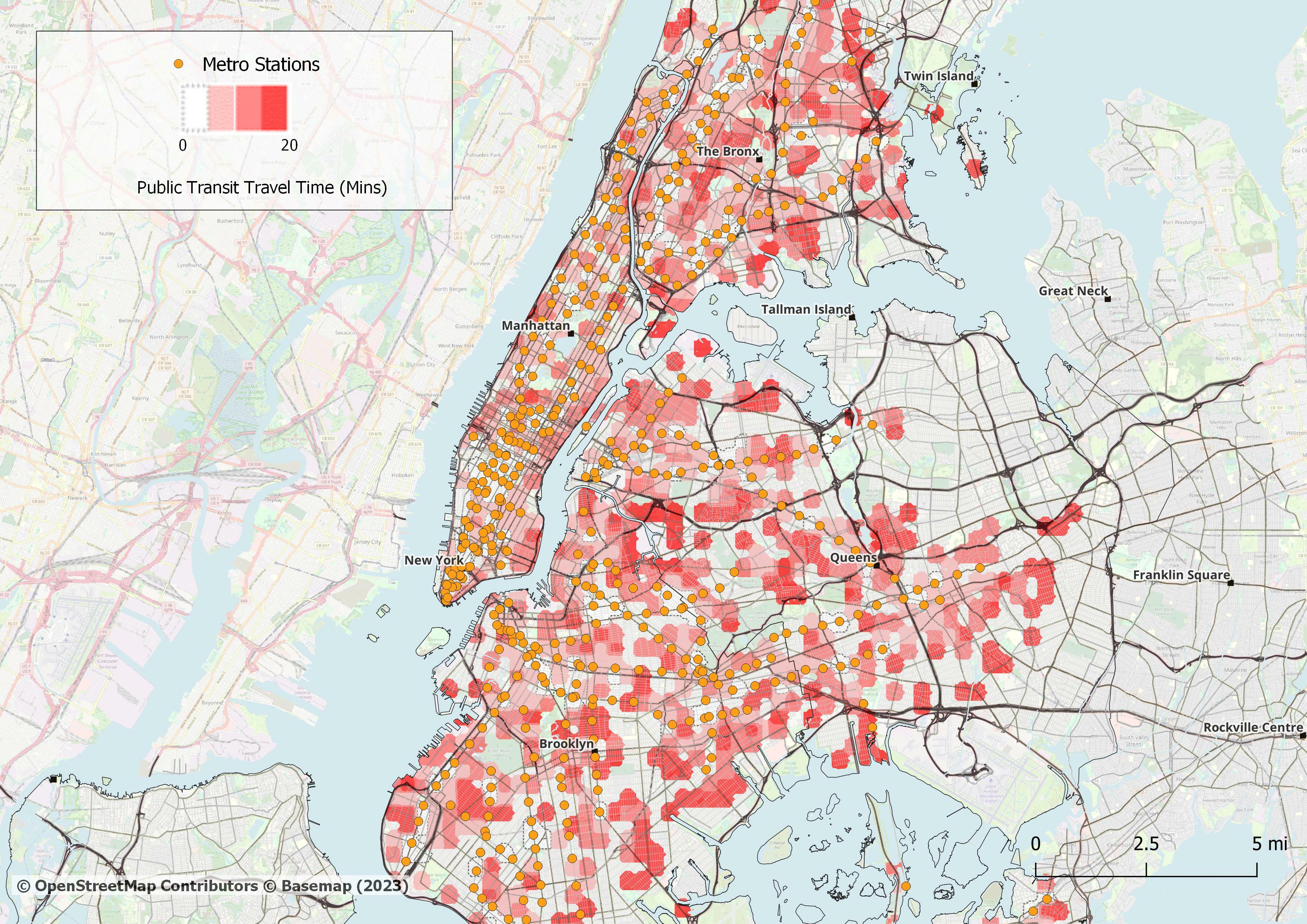
Within a 20 minute travel time window, walking access to Metro Stations has varied results visually. Lower Manhattan has the least amount of walking to arrive to a Metro Station, followed by The Bronx, Queens and then Brooklyn showing similar results.

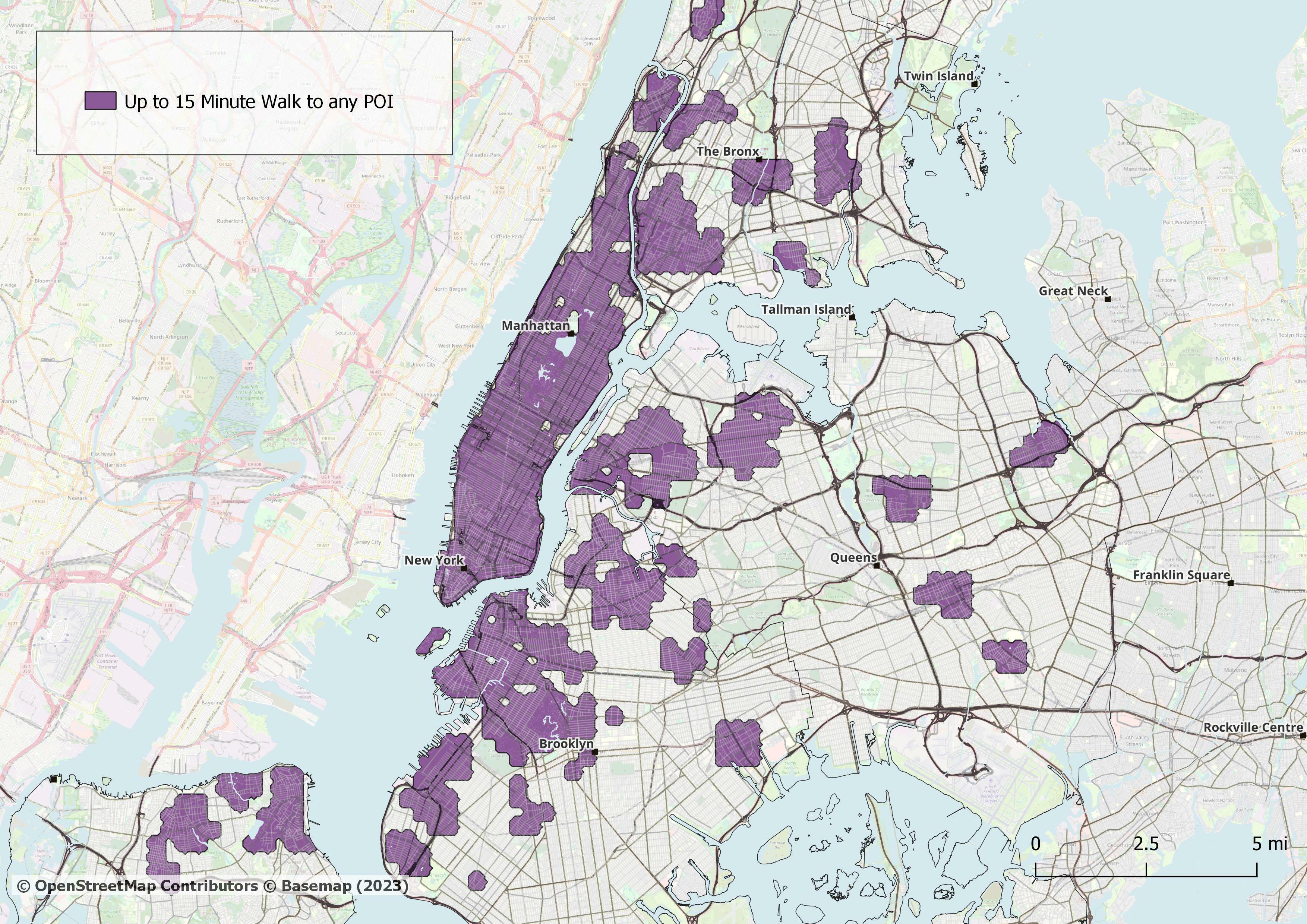
Given New York has a melting pot of cultural institutions, famous landmarks and intriguing places to visit, there is no surprise to see a dense map for walking to 'Places of Interest'.

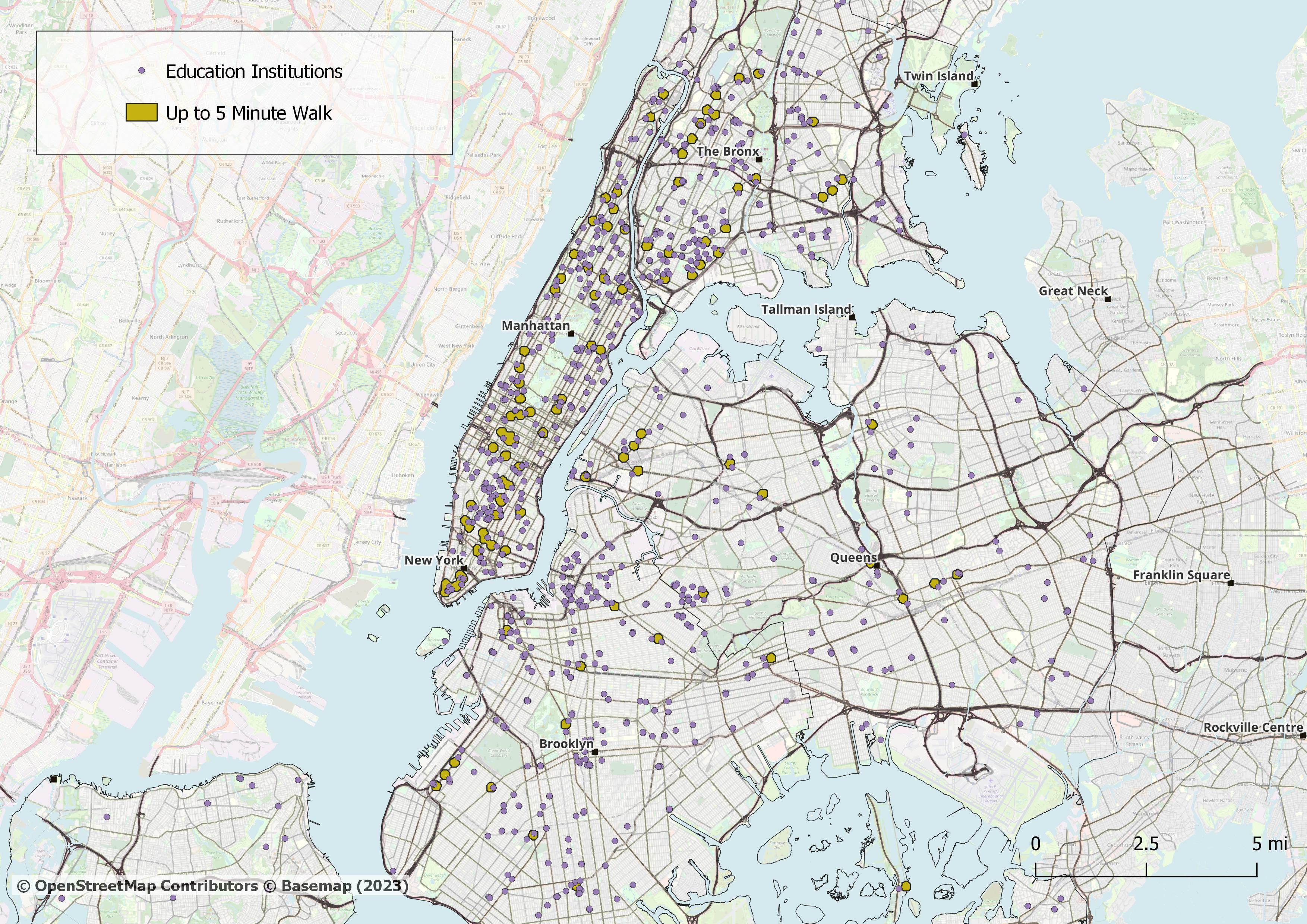
Most people in Manhattan can get to Educational Sites within 5 minutes of walk time from a Metro Station. However the picture isn't evenly distributed as you zoom out and assess Upper Bronx and Brooklyn. Queens appears to have less access to Educational Sites than other parts of the city.

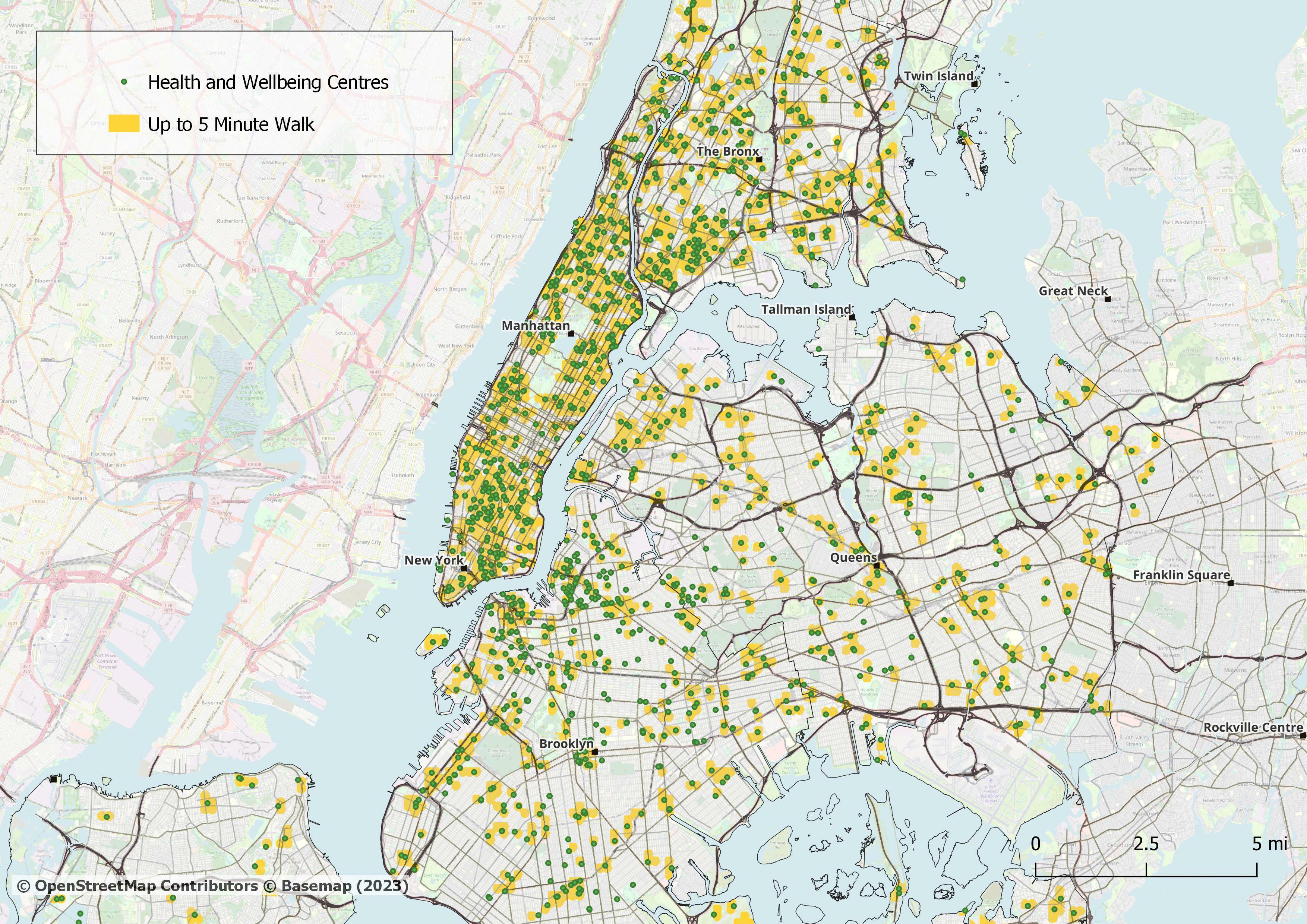
There is medium to high access to places of Health & Wellbeing in Manhattan from Metro Stations, however, following a similar pattern from the other maps above, there are pockets where access is lower in Upper Manhattan, Bronx as well as Queens and Brooklyn.

Wednesday (1st Slide)
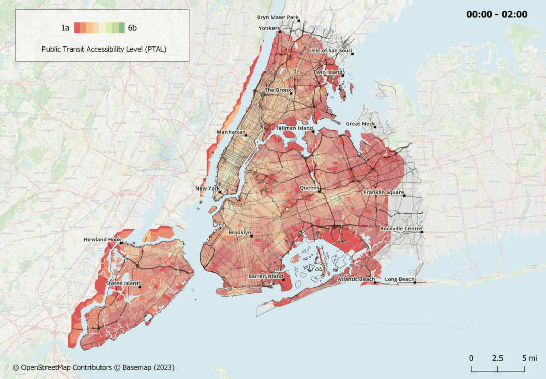
We can see access to hospitals is remarkably similar between Wednesday and Sunday, with Wednesday having slightly better access using the Public Transit network as a basis of our conclusion.
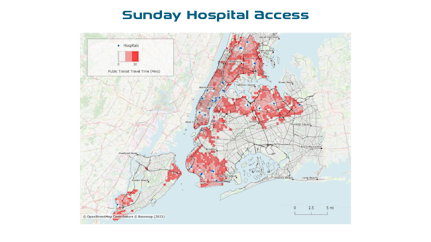
Sunday (2nd Slide)
The access to hospitals is very slightly worse on a Sunday compared to Wednesday.

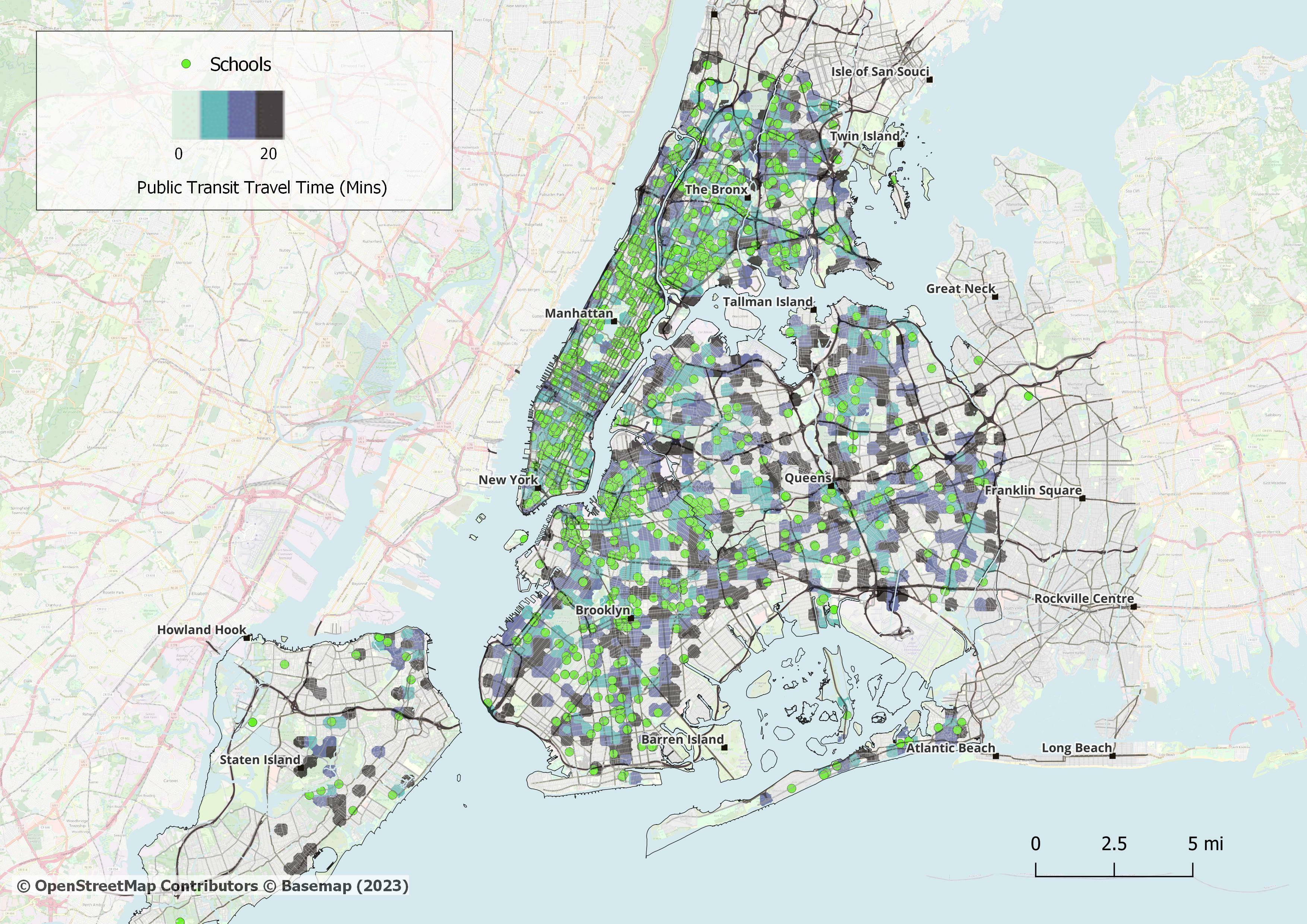
Direction TO Schools
We can see that access to schools and from schools does not vary at all with consistent access available throughout the day.
Direction FROM Schools
New York City's transit network to and from schools appears to be very consistent in access. Across a working day, the access to schools remains consistent.


Due to New York's layout being in a grid system, walking 15 to 20 blocks to places such as Wall Street can be achieved in 30 minutes on average. As seen depicted in the map to our left.

Day
It is not surprising to see lots of footfall of tourists flocking to Times Square during the day. Over hundreds of thousands walk around Times Square before dusk, where the crowds get busier.
Night
As services for the NYC Subway run 24 hours, coupled with the popularity of the evening lights adorning the Times Square billboards, There is little surprise that there is better access at night as a consequence.


Throughout our research, we have concluded that as a city New York's access has:
TRACC is a multi-modal travel time analysis tool used to analyse different modes to measure access and mobility. Travel times are generated for walking, cycling, public transit and cars. These can be visualized in precise contours, thematic maps and detailed reports which can be enhanced using demographic data to give an accurate view on accessibility. Data can then be edited to create what if scenarios, such as introduction of a new bus lane, route or service, removal of a service or creation of new footpaths and cycleways. TRACC can also allow new locations to be analysed such as hospitals or housing developments.
For this project we evaluated different points of access in New York City. This included access to hospitals, schools and cultural attractions. After obtaining mapping data and point of interest data, we used TRACC to visualise the access and generate time catchments to show the level of access across the day.