
Can Using The Proposed Superloop Give You Better Access to London Hospitals?
Transport for London announced earlier this month they are announcing a bus network that will run in both clockwise and anti-clockwise directions around London. An initial map of the planned Superloop incorporates seven separate but existing bus routes, taking in towns including Bexleyheath, Bromley, Croydon, Kingston, Harrow, Edmonton and Walthamstow in an almost circular route. Queen Mary's Hospital in Sidcup, Ealing Hospital, and Heathrow Airport have also planned stops on the network.

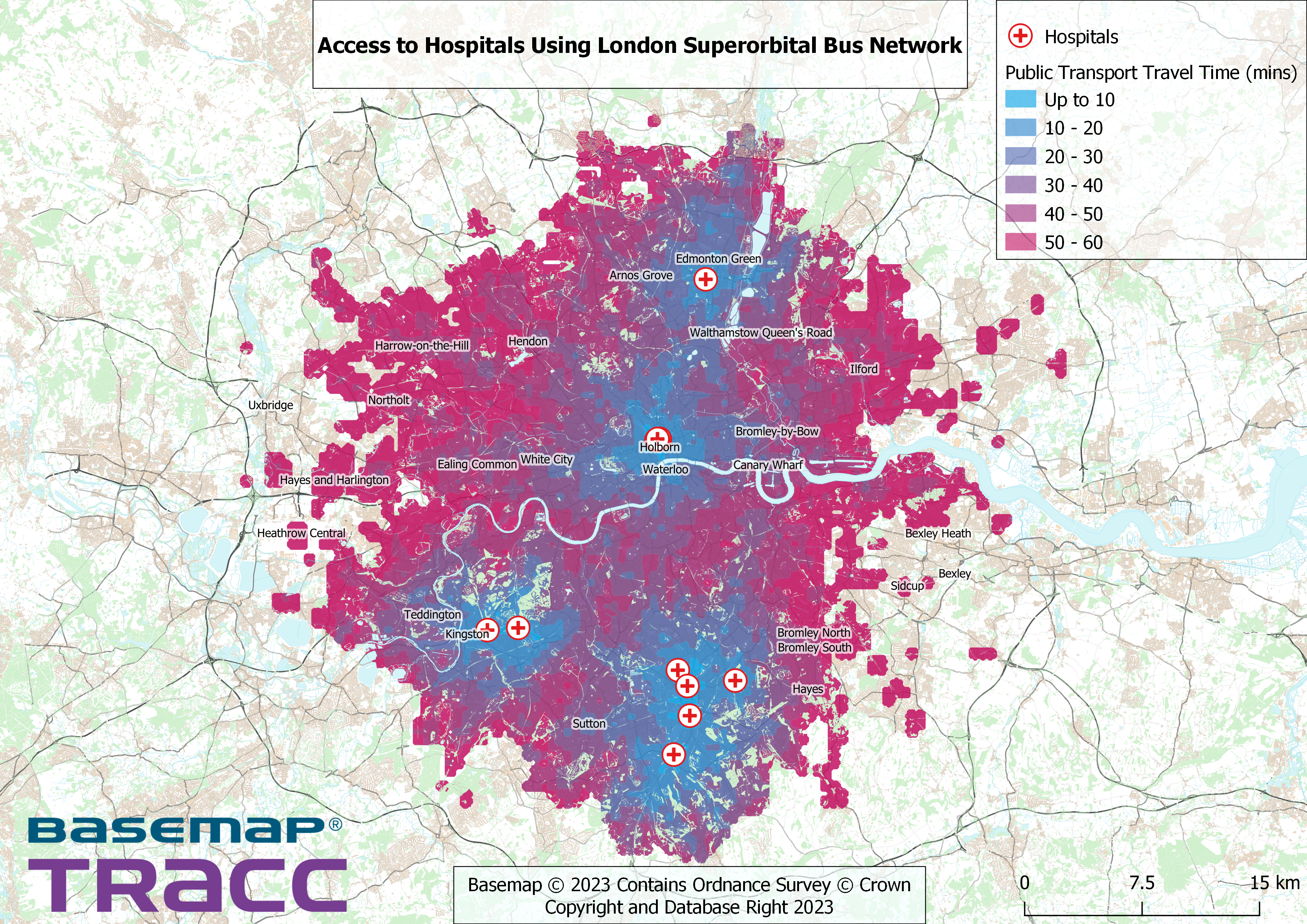
Access to Hospitals via Superloop
As a measure to increase public transport options and for people to get to the places they need, the proposed Superloop will benefit those needing to get to everyday amenities. Using TRACC and DataCutter POI data, we visualised the results of people using the Superloop to access London Hospitals in 10-minute catchments up to 1 hour. The services we added were based on existing routes and the timetable is based on a given Tuesday morning between 7am - 9am. The results show that the areas of Edmonton, Holborn, Croydon, and Kingston are the most accessible in the least amount of public transport travel time. However, there are gaps in several areas in East London with little to no access to hospitals using the Superloop.